
Waters of the Western Great Basin: A Symposium for Educators
Last week teachers of all levels, community members, and AmeriCorps VISTAs working with local nonprofit organisations gathered at the Peppermill to attend the Waters of the Western Great Basin: A Symposium for Educators. The Symposium was organized and run by the Nevada Division of Environmental Protection (NDEP) and Project WET. A big THANK YOU goes out to Mary Kay Wagner from NDEP and Nancy E. Lowe from the Great Basin Outdoor School (GBOS) for organizing and facilitating, as well as to all the speakers and sponsors who made the event possible!
Peppermill Highlights
Many in the Reno area have heard about the Peppermill’s recent geothermal installation and subsequent windfall of savings, but few have had the opportunity to get an in depth look at how it all works and what it means for mitigating energy costs. Dean Parker, Peppermill’s Executive Director of Facilities, gave all of the teachers a tour and explained that it all started when the Peppermill had to figure out ways to save money during the recession. They had to think outside the box for ways to save money, included many other alternative energy initiatives, but as Dean said, “It was a no-brainer [to choose Geothermal] when you get a four year return on your investment.” Honing their craft since 2007 the facility workers at the Peppermill have become experts in Geothermal. Their current system uses a 4,421 feet deep well that provides all of the heating and cooling needs for the entire 2.1 million square foot resort. Each year the Peppermill saves approximately $2 million dollars in heating and cooling costs.
Here’s a quick overview of what we learned and how the Geothermal works currently at the Peppermill:
- Water is pumped up at a constant 174℉ from the deep well, 4,421 feet below the property.
- The hot water heats copper tubes filled with municipal water in a heat exchanger in the Peppermill’s boiler room.
- The municipal water is pumped all throughout the resort to heat and cool all the rooms. The geothermal water is then pumped back into the aquifer where the Earth naturally reheats it to 174℉ to be used again.
- The peppermill has pursued many other green initiatives for their facilities, saving water, energy, and money in the process. You can read more here.
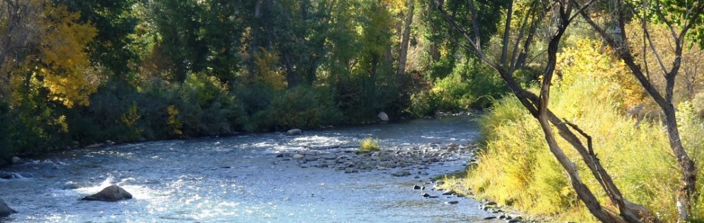
Our Western Great Basin Waters
A watershed is an area or ridge of land that separates waters flowing to different rivers, basins, or seas. The Great Basin is an enormous, enclosed, high desert between the Rockies and the Sierra where no rivers drain to the ocean (x). Covered over the two days of the Symposium was our three local watersheds: Truckee River Basin, Carson River Basin, and Walker River Basin.

Waters of the Western Great Basin – Click to enlarge image.
The Truckee River Basin starts with Lake Tahoe – about half the water in the lake flows into the lake via streams from snowmelt and rain, and the other half of the lake’s water falls directly onto the lake surface as snow and rain. The three biggest water issues facing Lake Tahoe include water clarity, climate change, and aquatic invasive species. Water from Lake Tahoe flows into the Truckee River – its only outlet – and into Pyramid Lake at the end of the watershed. Pyramid Lake faces issues unique to being downstream: water used upstream will no longer flow to fill the lake, water quality becomes worse as the water flows downstream, and wildlife that depend on the unique characteristics of the lake, like the Cui-ui lakesucker (Chasmistes cujus) and the Lahontan cutthroat trout (Oncorhynchus clarkii henshawi), become threatened as the lake is changed by human use. Pyramid Lake is located within The Pyramid Lake Paiute Tribe’s tribal reservation lands, and the lake is a central asset and important cultural component of the tribe.
Read more about the Truckee River Basin watershed.
The Carson River Basin begins with the East Fork and West Fork of the Carson River. The two forks join to form the Carson River and flows north and east to the river terminus at the Carson Sink. One way this watershed is different than the Truckee River Basin is that there is no big water reservoir at the beginning of the watershed to store water for later use, like Lake Tahoe. The Carson River Coalition Educator Working Group and the Carson Water Subconservancy District have been working together since 2007 to implement a Carson River Watershed-Literacy Action Plan with the goal to “increase awareness that human behavior affects watershed health and to use education to promote changes in behavior that will ultimately improve habitat, water quality, water supply, and benefit the watershed as a whole.” You can learn more about the plan and the objectives they have made to achieve this goal in the most up to date 2015 version of the plan here.
Read more about the Carson River Basin watershed here.
The Walker River Basin begins with the East Walker River and the West Walker River, and after converging, ends in Walker Lake – the terminus of the watershed. Since the late 1800’s, the lake has dropped more than 150 feet, which has resulted in much higher amounts of dissolved solids in the lake water. The quality of the ecosystems along the river have also been degraded over time due to the river being channeled (straightened) and separated from the surrounding floodplain. In an effort to restore a section of river ecosystems for local wildlife and to help with overall water quality, the U.S. Fish & Wildlife Service and the Nevada Department of Wildlife are working with Otis Bay to revert a straight river section back to a meandering curved section of the river. Since the Walker River Basin has seen less overall human development compared to the Truckee River Basin, there exists more and easier ecological restoration potential.
Read more about the Walker River Basin watershed here.
Come back tomorrow for Part 2, when we will describe what you can do right now to help your local watershed and share some resources for where you can learn more about impacting your local water for the better!
Written by
Aaron and Molly Heit,
AmeriCorps VISTAs serving at Envirolution.


Pingback: Be #watersmart by getting to know your watershed – Part 2 | GREENevada